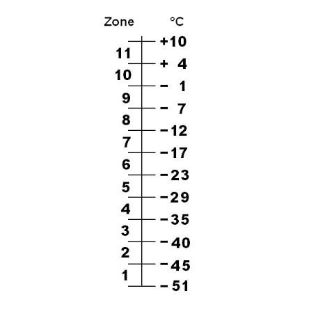
Hardiness zones maps are used to determine if a specific plant can be grown in the climate of a specific location. They are used by gardeners as well as professional growers. Hardiness zones were firstly used by the department of agriculture(USDA) in the United States but today also widely used in the rest of the world. Hardiness zones are based on the average minimum temperature of the area which is determined by the locations elevation, latitude and proximity to the coast The scale is ranging from the coldest zone 0A to the warmest zone 12B, each divided by 10 degrees Fahrenheit.
Hardiness zones are a great indicator to determine if a plant species is suitable for an area but one should be aware that average minimum temperature is not the only factor that influence plant survival. Important factors like summer heat, extreme temperature drops, precipitation or snow coverage are not included in the hardiness scale and should always be added to gain the best insight in an area.